Zubairul Islam
Professor, Coordinator, Remote Sensing & Geospatial Sciences.
Consultant. JSI Research and Training Institute, Inc., 44 Farnsworth Street; Boston, MA, USA 02210.
Email> zubairul@gmail.com, +91-9821405543 (India)![]() YouTube Channel
YouTube Channel
Geospatial Courses
Research Journal
My Colab Notebooks: Using Python Libraries
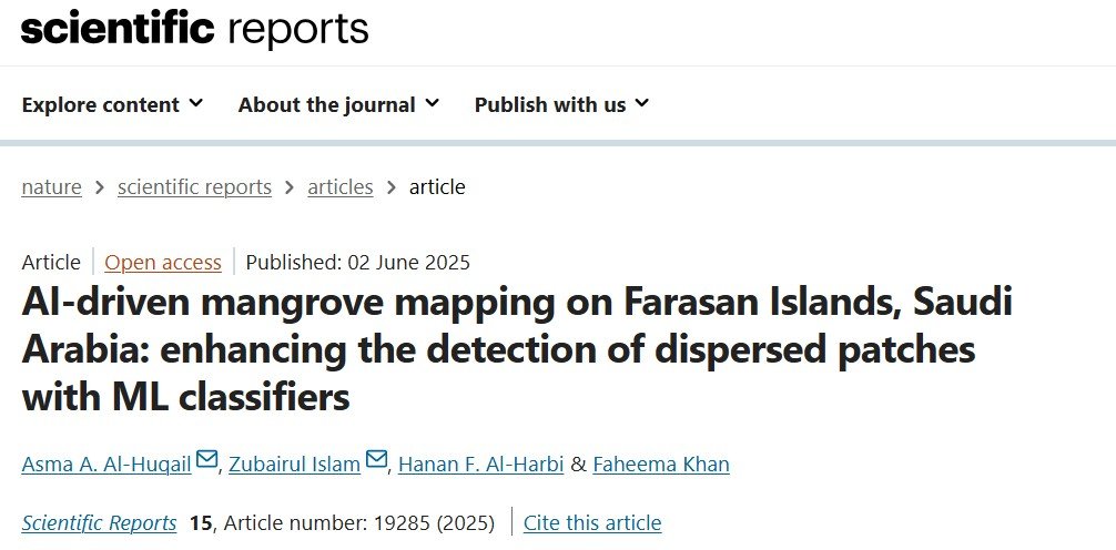
Recent Publications


Mapping Applications
Settlements Beyond 5 km from Health Facilities
Building Foot Prints
Zero Dose and Under immunized Children
Courses
Advanced Remote Sensing in Policy Making
Advanced Remote Sensing in Military Studies
Introduction to Economics of Climate Emergency
Advance Remote Sensing
Remote Sensing
Advance GIS
GPS
Data Journalism and Reporting in the Extractive Industry
Communication Issues in the Niger Delta
GEOGRAPHY
Geography: Definitions, Themes, Branches & Development
The Earth & Its Interior
The Earth Surface Features
Oceans: Introduction, Relief Features
Oceans: Water Characteristics & Movement
Ocean: Resources
Wetlands
Atmosphere: Introduction, Composition & Structure
India Geology Physiography & Drainage
India Climate Vegetation & Soil
India Transportation & Tourism
India Protected Areas Climate Change Natural Disasters
INDIAN HISTORY
INDIAN CULTURE
INTERNATIONAL RELATION
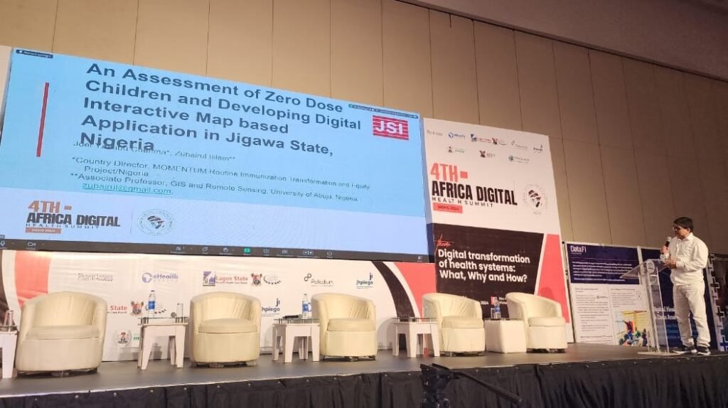
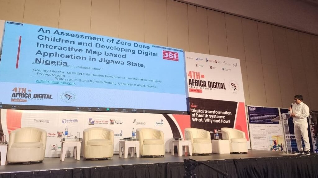
RESEARCH JOURNAL
Indo-African Journal for Resource Management and Planning
MOOCs
Massive Open Online Courses (MOOCs)
Curriculum Developed
Proposal and Curriculum for Post Graduate Programme in GIS & Remote Sensing
Proposal and Curriculum for PhD in GIS & Remote Sensing
 DATA DEVELOPED
Socio-Economic Data
Vegetation Data
Water Data
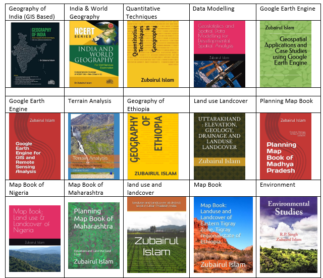
Books